I’ve managed to activate the GPS functionality in my phone, so I can use it as a GPS datalogger. This is super-cool and exciting for me, especially because there’s already a nice program called TurboGPS that does pretty much everything I’d want it to do on the data recording side… and Google Maps does everything I’d want from the navigation side.
The VZW Navigator has limited usefulness to me because I don’t need turn-by-turn directions. My car has a very nice GPS already and I don’t want to be that distracted while on the bike. Nor do I want to actually spend money on this functionality, because I might as well just get a real GPS datalogger instead of hacking with my phone.
So as soon as I had the software working, I took some GPS tracks. Just because that sounds really cool.
But this brings to mind the next question… what to do with a GPS track? First thing I tried was loading it into Google Earth but that’s not nearly cool enough for me. Then I tried mapmyride but even that was not quite cool enough. Then I found GPSVisualizer.com, which does some interesting stuff…
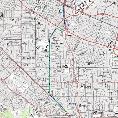
I plotted the path I took between the train station and my soon-to-be-former apartment complex and colored it by the speed I reached:
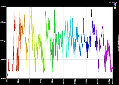
And then I plotted my speed vs. time:
I dono. I guess what I’d like to be able to do is take a GPS file and get some interesting statistics. Clearly for a stop-and-start commute, knowing that the average speed is around 10 mph isn’t nearly as useful as the average speed when I actually was going someplace. Or maybe generate a “here’s how hard you worked” pseudo-approximate calorie expendature count. Or something fun like that. But GPSVisualizer is probably the coolest so far, even though it requires some manual effort.